Category Archives: Hazard Monitoring

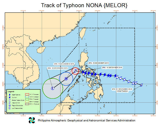
Nona slows as it crosses Northern Mindoro

typhoon melor
Philippine Atmospheric Geophysical and Astronomical Services Administration (PAGASA)
PAGASA says Typhoon Nona currently has maximum sustained winds of 140 km/h near the center and a gustiness of up to 170 km/h. It is forecast to move west at a rate of 11 km/h.

MANILA, Philippines (Dec. 16, 2015) — According to state weather service PAGASA, Typhoon Nona (international name Melor) has slowed down as it made its way across Northern Mindoro.

Continue reading Nona slows as it crosses Northern Mindoro

Tropical Storm Lando slightly weakens

MTSAT ENHANCED IR satellite image, 4:01 pm, October 20. Image courtesy of PAGASA

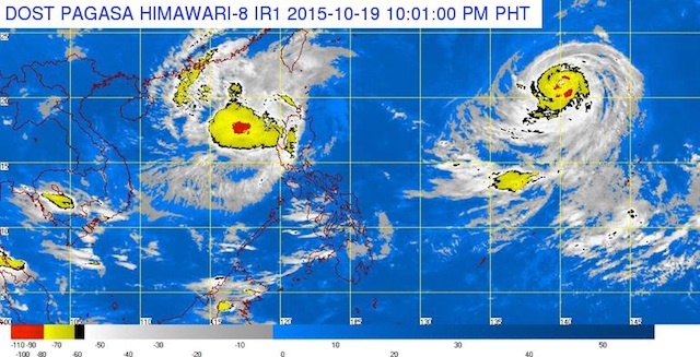
MANILA, Philippines (Oct. 20, 2015) — Tropical Storm Lando (international name Koppu) has slightly weakened on Tuesday afternoon, October 20 and it continues its slow approach to Calayan and Babuyan group of islands.

Continue reading Tropical Storm Lando slightly weakens

Lando weakens into tropical storm

MTSAT ENHANCED IR satellite image, 10:01 am, October 20. Image courtesy of PAGASA

MANILA, Philippines (Oct. 20, 2015) — Severe Tropical Storm Lando (international name Koppu) has weakened into a tropical storm on Tuesday morning, October 20 as it moves slowly towards Calayan and Babuyan group of islands.

Continue reading Lando weakens into tropical storm

Typhoon Lando - Signal No 2 in 10 Luzon provinces

typhoon lando
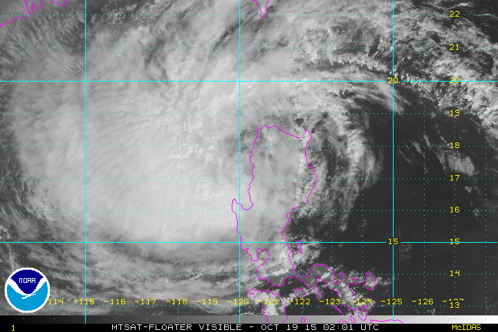
MTSAT-FLOATER Visible image of Typhoon Lando (Koppu) Oct 19, 2015, 2:01 UTC. Image courtesy NOAA

MANILA, Philippines (Oct. 19, 2015) — A number of provinces in northern Luzon are still under public storm warning signal number 2 as Typhoon Lando (Koppu) continues its slow march in the area Monday, October 19.

Continue reading Typhoon Lando - Signal No 2 in 10 Luzon provinces

Typhoon Lando to exit landmass earlier - PAGASA

typhoon lando
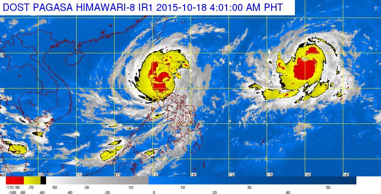
Image as of 11 pm on October 18, 2015, courtesy of PAGASA

MANILA, Philippines (Oct. 19, 2015) — The state weather bureau on Sunday evening, October 18, said Typhoon Lando (Koppu) continues to move slowly toward the Ilocos and Cordillera regions, and is seen to exit the Philippines’ landmass earlier than expected.

Continue reading Typhoon Lando to exit landmass earlier - PAGASA

Typhoon Lando continues slow march through Luzon

typhoon lando
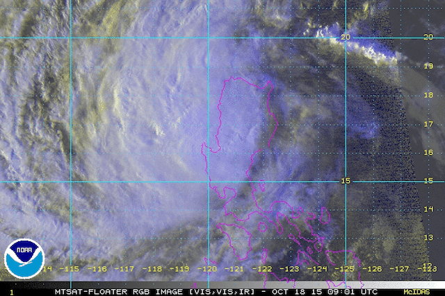
MTSAT-Floater RGB image Oct 18 2015 9:01 UTC, showing Typhoon Lando over Luzon. Image courtesy NOAA

MANILA, Philippines (Oct. 18, 2015) — Typhoon Lando (Koppo) continues its slow march through Northern Luzon on Sunday, October 18, and is expected to linger over Luzon for most of the coming week.

Continue reading Typhoon Lando continues slow march through Luzon

Typhoon Lando slightly weakens, picks up speed

typhoon lando
Image courtesy of DOST-PAGASA

MANILA, Philippines (Oct. 18, 2015) — Typhoon Lando (international codename Kappu) has weakened slighty and has picked up some speed late Sunday morning, October 18, as it crosses Nueva Ecija, heading towards the Cordilleras.

Continue reading Typhoon Lando slightly weakens, picks up speed

Lando now a super typhoon – JTWC, Weather PH

typhoon lando
Image of Lando from Weather Philippines

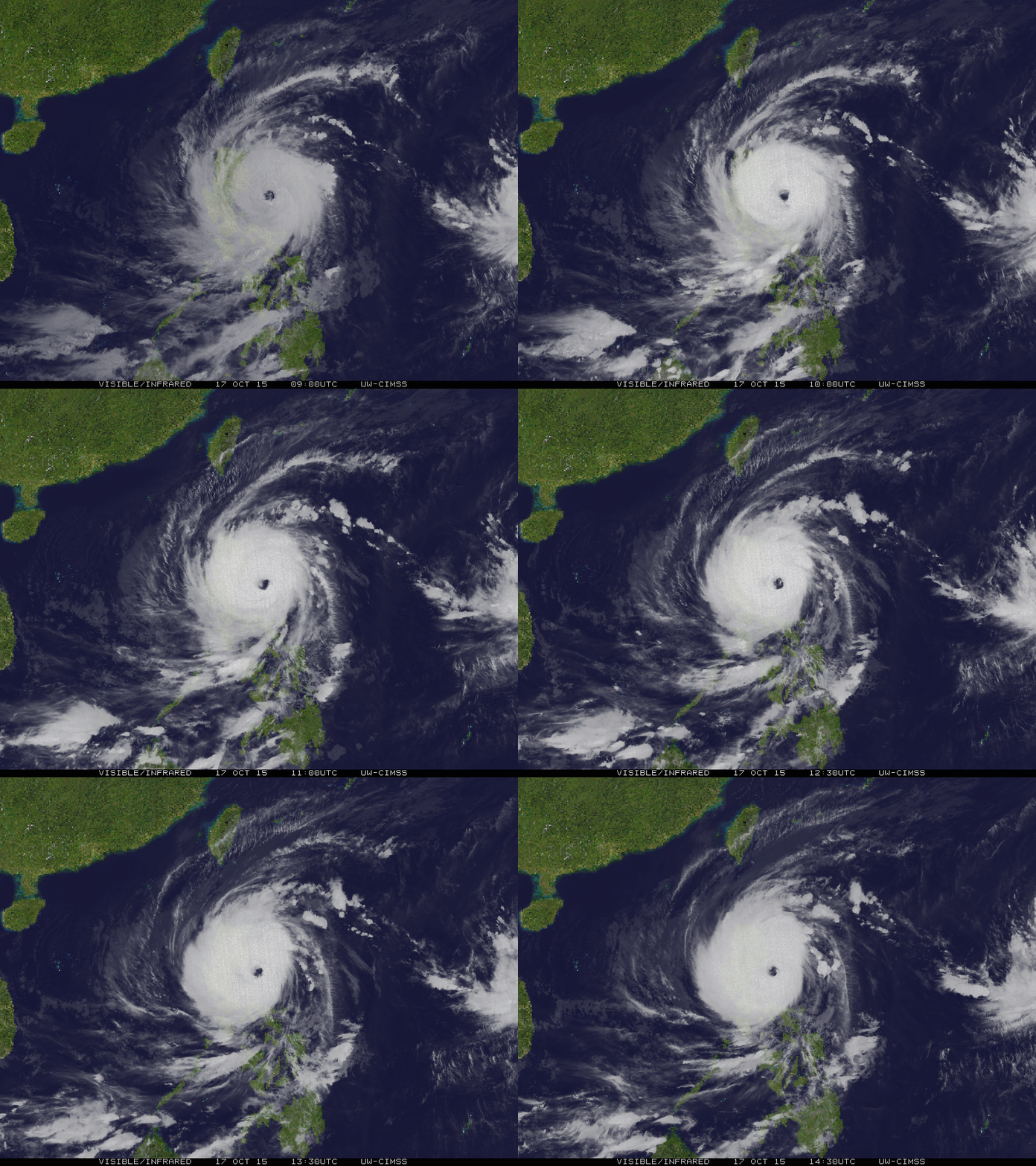
MANILA, Philippines (Oct. 18, 2015) — The United States Navy’s Joint Typhoon Warning Center (JTWC) upgraded Typhoon Lando (Koppu) to super typhoon status on Saturday at 11 pm, October 17.

Continue reading Lando now a super typhoon – JTWC, Weather PH